Storm moves out of Philadelphia region; much colder Tuesday

6abc Digital Staff Image
Last updated: Tuesday, March 17, 2026 5:49AM GMT
Live StormTracker 6 and Sky 6

PHILADELPHIA (WPVI) -- The threat of severe weather has moved out of the Philadelphia region.

There were Tornado Warnings issued in Kent County, Delaware, and parts of New Jersey, late Monday, but all warnings have since expired.

Temperatures quickly tumble overnight as cold air takes over. A wind advisory is posted for the entire region until 2 a.m. Tuesday.

Click here for the latest AccuWeather forecast.

ByAmanda Pitts WPVI logo
Mar 16, 2026, 9:22 PM GMT

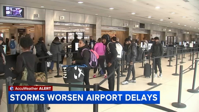
Storms cause hundreds of delays and cancellations at PHL

Travelers at Philadelphia International Airport faced delays and cancellations on Monday due to severe weather across the country and a partial government shutdown.

Airport operations in Philadelphia appeared calm at times, but the impacts were visible on departure boards. Hundreds of flights were delayed or canceled in and out of the airport as storms swept across the United States.

"There's a lot of hanging out happening" at the airport, said Tom Tussing of Scappoose, Oregon, who arrived early after receiving alerts about potential delays.

"We got a lot of alerts on our phone that said the weather was gonna delay flights. So, we came to the airport about six hours early," Tussing said.

Travel headaches due to weather, partial government shutdown

The severe weather has caused widespread problems nationwide, particularly in Chicago, where hundreds of flights have been canceled or delayed. Those disruptions are rippling through connecting flights for travelers in Philadelphia.

"It's scheduled for 7 p.m., but we're already delayed. So we're hoping to make our connection in Chicago to get back to Omaha tonight. We'll see!" said Stacy Arndt of Omaha, Nebraska.

Despite the delays, some travelers remained optimistic about making it home.

"We'd like to go to work tomorrow. But if we can't, it's no big deal!" Arndt said.

Others were less fortunate.

Melissa Bird of Dallas said her flight home had already been canceled.

"We were supposed to fly home yesterday, and it was just canceled," Bird said.

The storm is also hitting during the busy spring break travel period, increasing crowds at airports across the country.

Compounding the issue is a partial government shutdown that has stretched Transportation Security Administration staffing.

More than 360 TSA agents have quit, and the weekend saw the highest call-out rates so far during the shutdown, which has entered its fourth week.

Agents have now missed one full and one partial paycheck.

The staffing shortages have led to longer security lines, including at Hartsfield-Jackson Atlanta International Airport, where travelers reported waiting nearly two hours at security.

Travelers say the possibility of longer TSA lines is another reason they're arriving earlier than usual.

"I know there's been some TSA slowdowns recently, so we like to be here with plenty of time. We don't like to rush to the gate," Arndt said.

Others were simply hoping their travel plans wouldn't change.

"It says my flights are on time for now, so fingers crossed," said Gina Correla of Los Angeles.

As of early Monday afternoon, there had been more than 6,300 flight delays and more than 3,500 cancellations nationwide.

At Philadelphia International Airport alone, over 220 flights were delayed and just over 160 were canceled as of Monday at 6 p.m.

Cecily Tynan Image
Mar 16, 2026, 9:02 PM GMT

Tornado threat diminishing

The western suburbs have been removed from the tornado watch.

Thick cloud cover has limited surface instability, keeping storms from turning severe.

We still have the strong straight-line winds with the cold front to watch, late this evening.

Trish Hartman Image
Mar 16, 2026, 8:27 PM GMT

Crews cleaning storm drains ahead of possible downpours

With the region under a tornado watch, folks were trying to plan their day to avoid traveling in severe weather.

"My car doesn't do really well in the rain, so we're just trying to get out as early as we can," said Dalexa Rodriguez of Reading, Pa.

Rodriguez and Kiancy Reyes were heading back to Penn State's main campus on Monday.

Crews cleaning storm drains ahead of possible downpours

"You just gotta keep your head on a swivel, pay attention. We'll be fine," said Kiancy Reyes of Bristol Twp., Pa.

They hit the road early, hoping to avoid some nasty weather.

Officials say crews in New Jersey and Pennsylvania spent the day cleaning storm drains and inlets in preparation for downpours.

"Today, they are picking up litter, which will hopefully prevent clogging storm drains or just having other obstructions along the road," said Helen Reinbrecht, PennDOT's District 6 Community Relations Coordinator.

Another concern with high winds expected: downed trees, wires, and power outages.

"PECO has developed an enhanced staffing plan for this event to ensure we have additional field crews on hand and on standby to respond to any outages to safely restore service for our customers," said PECO spokesperson Izamarie Camacho.

PECO says they're monitoring conditions and will call in help from outside the area if needed. They're urging people to be safe in case of an outage - and to be prepared.

"PECO customers should always assume that equipment is energized. We tell customers to report downed power lines by contacting us at 1-800-841-4141," added Camacho.

Mar 16, 2026, 7:56 PM GMT

Strongest wind gusts likely still to come

Remain weather aware the rest of this afternoon and well into Monday night.

The severe threat for our area will not be over until almost midnight.

Temperatures crash behind this front and the next two days will be around 10 degrees below average.

We're watching the low-level jet, which is a band of very fast winds about a mile above the ground. It peaks this evening & helps produce intense wind gusts at the surface. Watch for tree limbs, power-lines, & even outages.