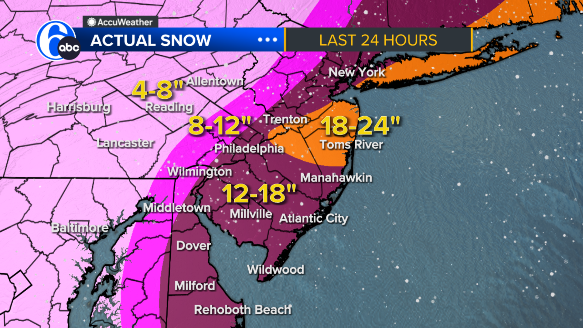
NEW MAP: Snow totals increased for weekend storm
A weekend storm threat is looming for parts of the Philadelphia region.
A large portion of the Philadelphia region could see between 8 to 12 inches of snow, according to the latest models.
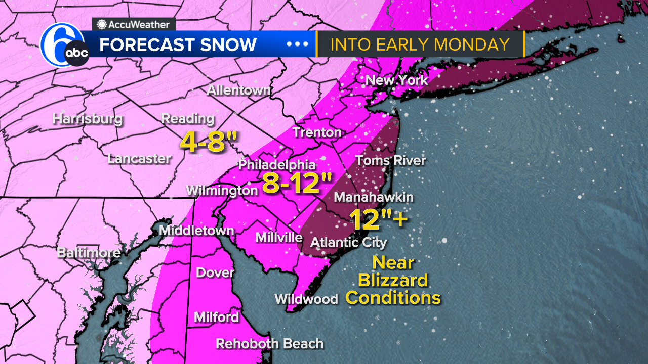
HOW MUCH SNOW?
The storm is expected to bring between 8 and 12 inches of snow to parts of South Jersey and Delaware, with a band of 12+ inches along some shore points. The Philadelphia metro area could see anywhere from 8 to 12 inches, and areas west will see less accumulation.
TIMELINE
As temperatures drop, precipitation will changeover to snow for all areas by Sunday evening.
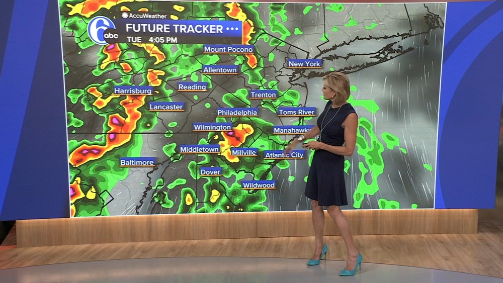
Light precipitation is expected to begin Sunday morning. Areas northwest of Philadelphia will likely begin with light snow showers. With ground temperatures above freezing and temperatures in the mid 30s, snow will likely initially melt as it hits the ground.
A mix of rain and snow is expected around Philadelphia, with rain showers for areas south and east.
The high temperature on Sunday is forecast to reach about 39 degrees, but temperatures are expected to fall late in the day. As temperatures drop later in the evening, any rain or mixed precipitation will change to snow for all. The timing of the heaviest snow overnight leads to ideal conditions for accumulations.
Drivers are urged to use caution and consider staying off the roads from Sunday evening through Monday morning as snow continues and snowfall rates pick up.
By Monday morning, snow will begin tapering off west to east as the coastal storm continues to strengthen and move away from the coast.
KEY IMPACTS
Possible blizzard conditions with thundersnow in southeastern NJ and southern Delaware, thanks to very strong lift developing in the atmosphere.
Wind gusts along the coast will likely reach 50 mph.
Coastal flooding and beach erosion are likely.
Stay with Action News and AccuWeather as the storm moves closer to the region.