Models show the storm continues tracking north. Here's what that means
The latest forecast models continue to nudge this weekend's winter storm track farther north.
The Euro model shows an area of low pressure to our south helping to steer the system, leading to the potential for an icy mix across parts of our region.
Some locations, including southern New Jersey and southern Delaware, could even see a period of rain before the storm wraps up, the Euro shows.
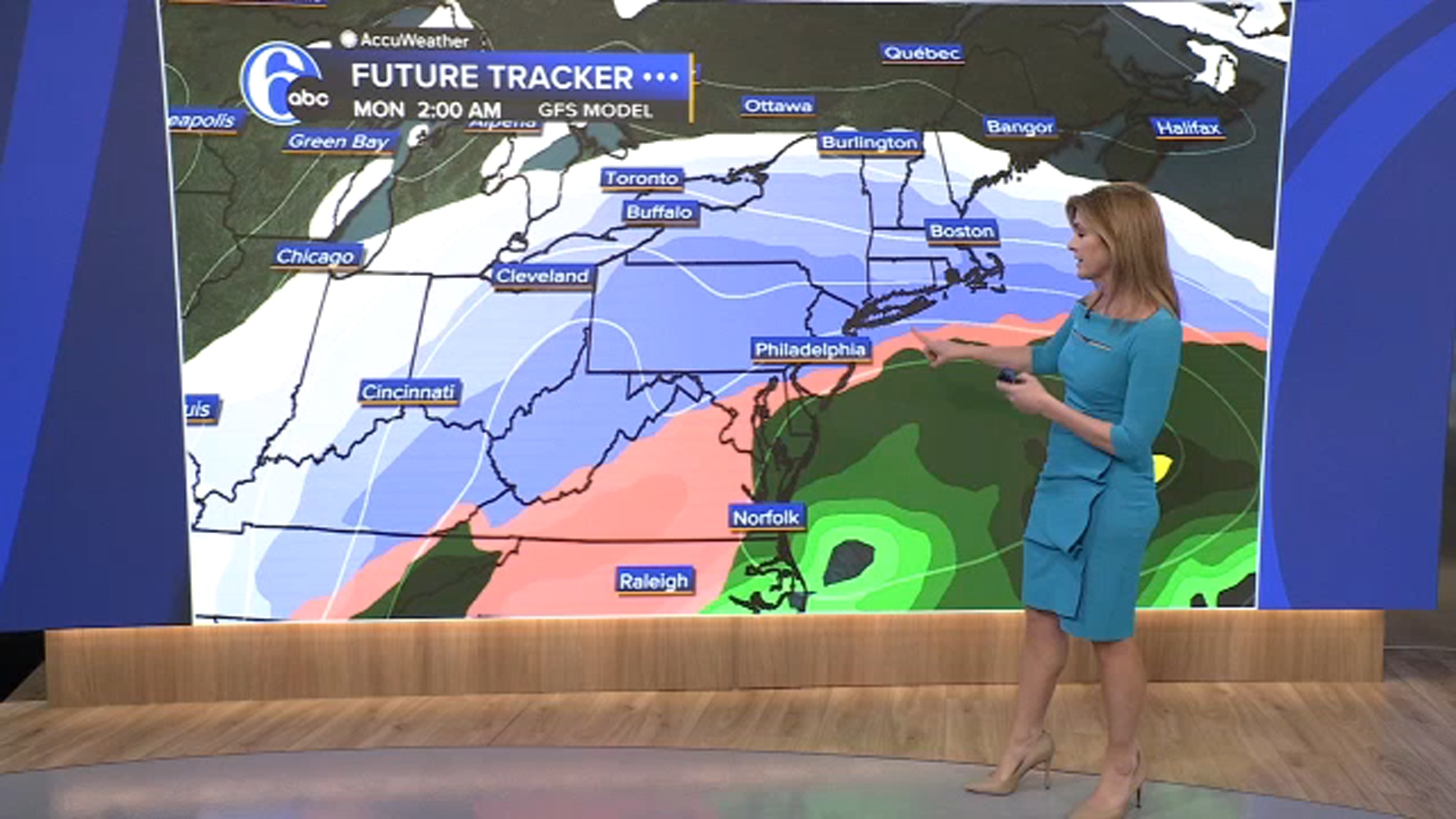
The GFS model is also trending warmer, now showing more mixing across the Philadelphia region and even some rain in Delaware.
That's a notable shift from just a day ago, when it had projected all snow across the area.
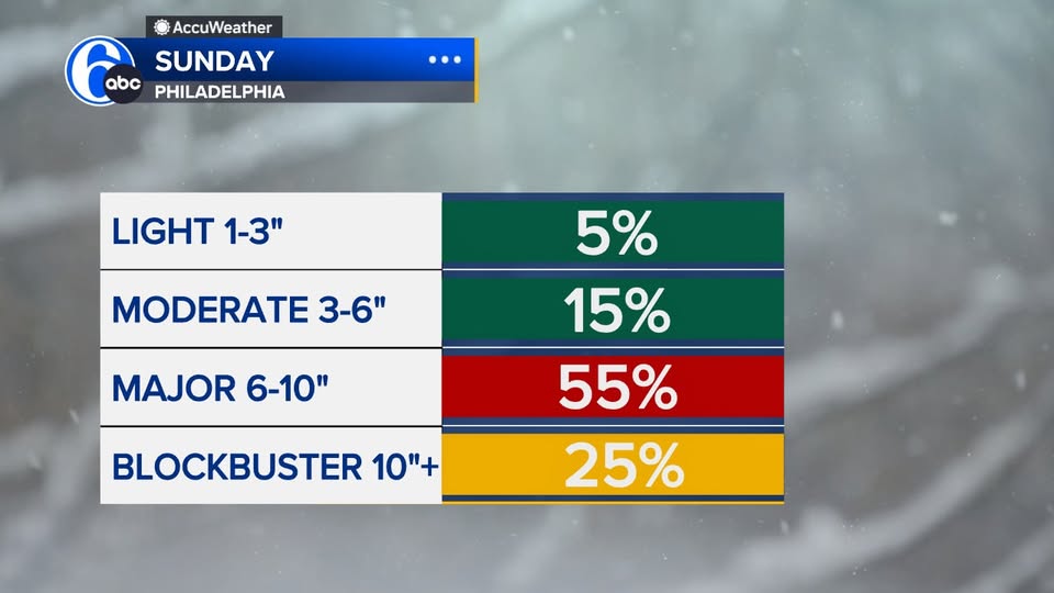
AccuWeather is currently calling for a 55% chance of a major snowstorm with 6 to 10 inches of accumulation.
There's also a 25% chance that totals could exceed 10 inches.