Tracking a potential nor'easter for Wednesday

PHILADELPHIA (WPVI) -- AccuWeather is tracking what could be another nor'easter coming up this week.
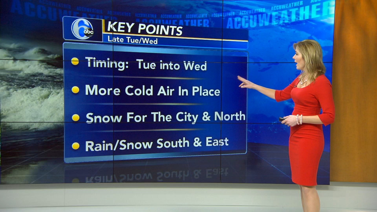
Here are some key points:
According to models, the timing looks to be Tuesday into Wednesday.
There is more cold air in place, unlike last week's nor'easter where there were 60-degree temperatures before its arrival.
It looks like it will be snow for Philadelphia and areas north.
And depending on the track, the rain/snow line will be south and east of the city.
The National Weather Service has already issued a Winter Weather Watch for the Lehigh Valley.
There are two scenarios we are keeping an eye on:
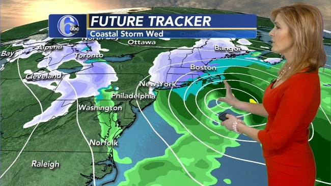
The first scenario sees the primary low moving through the Great Lakes and transferring its energy to a secondary low which is near the coast. That coastal low kicks back moisture and wind. This would bring snow back into the Philadelphia area, some of it would be heavy at times. There is potential for a plowable snow in parts of our area with this storm scenario. This model
calls for a 6 to 12 inch range of snow for the Lehigh Valley and 3 to 6 inch range for the city. Again, this is only one model's projection as of Monday morning and things could change as we get closer.
The second scenario is a little bit different. The primary low hands off to the secondary low which is much farther out to sea than in the first scenario - and much farther to the north. So by the time this storm gets going, this would be mainly a problem for New England. Our area would see a bit of snow and wind.
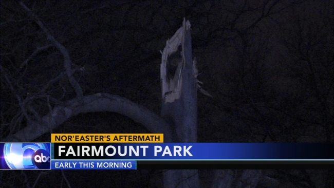
The Delaware and Lehigh valleys are still cleaning up after Friday's nor'easter blew down trees and power lines, and knocked out power to thousands of residents.
------
Send a News Tip to Action News
Learn More About 6abc Apps