39 minutes ago
Get Severe Weather Alerts at 6abc.com/Weather
Severe weather alerts are in effect across the region Tuesday as a line of powerful storms moves through.
For the latest alerts in your area, visit this page at 6abc.com/Weather.

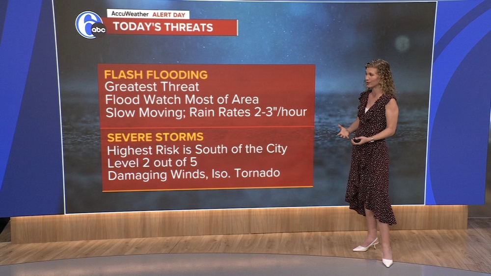
Downpours and storms could develop at any time today with intense rainfall and even gusty winds.
Tuesday will be the most active day this week with unsettled weather possible at any point of the day. Tropical humidity will fuel our biggest risk of flooding downpours.
A severe weather risk exists too, which is slightly elevated south of the city. Other than intense rainfall, damaging wind gusts and a brief tornado are possible. High 79.
Severe weather alerts are in effect across the region Tuesday as a line of powerful storms moves through.
For the latest alerts in your area, visit this page at 6abc.com/Weather.
Severe weather alerts are in effect across the region Tuesday as a line of powerful storms moves through.
For the latest alerts in your area, visit this page at 6abc.com/Weather.
A Tornado Warning that had been in effect for Northampton and Monroe counties in Pennsylvania earlier Tuesday afternoon has expired.

New Jersey communities hit hard by recent storms are bracing for another possible round of severe weather on Tuesday.
Camden County's Office of Emergency Management said it is keeping eye on communities close to the Delaware River, including the city of Camden, Pennsauken, Gloucester City and Brooklawn.
The high water rescue vehicle is ready to go in case anyone needs to be rescued due to flash flooding in the region.
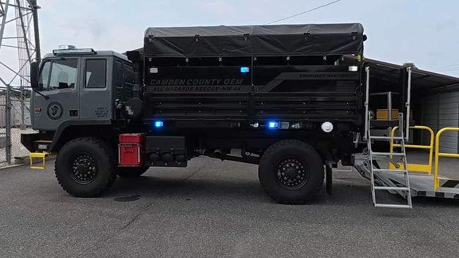
"We're able to go through flooded water with that up to five feet. As we've seen recently with these flash floods, cars get stuck in water. This vehicle is able to get to those cars," said Joseph Hales, the Emergency Management Coordinator for Camden County.
Camden County has had the vehicle since 2023 - purchased with Homeland Security funds - and they've used it to rescue people from floods and in heavy snow.
As severe weather moves into our area, officials remind people of the dangers of driving or wading into flood water.
"It's the hazards you can't see under the water: The manhole covers, the storm grates, debris. Things like that where you can't see it and once you realize it it's too late," Hales said.
The communications center is also ready to field a possible influx of 911 calls, with more staff on standby if they're needed.
"We definitely need more call takers when that happens. Everybody has a cell phone. Everybody is calling in the same call. We'll get maybe three calls for that one location," said Jeannie Moore, the Communications Chief for Camden County.
During the storm that hit on July 6, the county fielded over 800 calls in four hours - triple the number of calls they would normally get.
The same storm system impacting the Philadelphia region on Tuesday spawned tornadoes and severe thunderstorms in the Midwest.
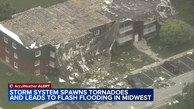
An EF-2 tornado that touched down in Wisconsin on Monday, ripping off roofs from homes and destroying businesses.
In Chicago, the storms triggered flash flooding. Many drivers were forced to leave their vehicles behind.
Hundreds of thousands of customers are still without power Tuesday.