Residents fleeing 'catastrophic' Hurricane Laura arrive in Philadelphia

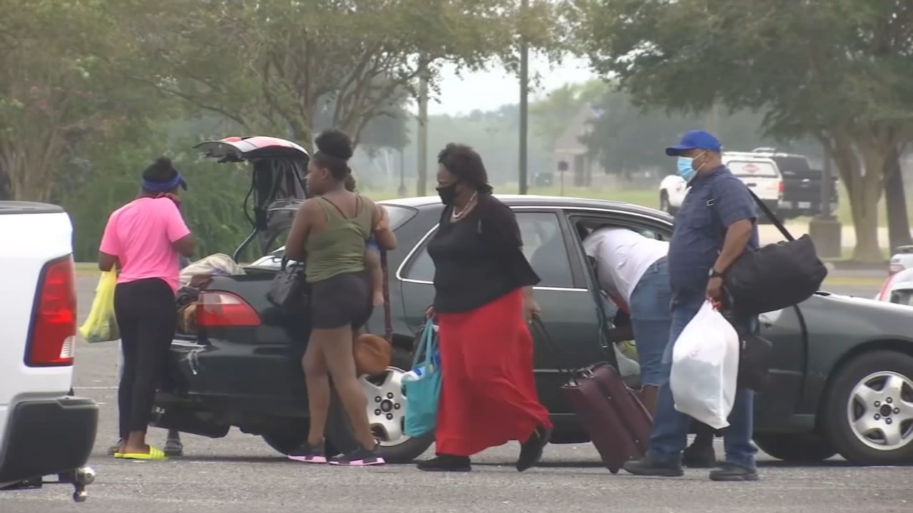
PHILADELPHIA (WPVI) -- Some residents fleeing a direct hit from Hurricane Laura arrived in Philadelphia on Wednesday as the storm nears the Louisiana coast.
"When we were leaving, you could see the weather was building up, you could see it starting to get really windy, it started to get really dark. And when we left the turbulence was pretty bad," said Neftalis Reynoso of Hazleton, Pennsylvania.
They say residents were rushing to finish last-minute preparations as Louisiana Governor John Bel Edwards was warning this could be the strongest storm to hit the Southwestern part of Louisiana in more than six decades.
"They're putting sandbags everywhere and closing, they're putting the shutters down, they're preparing, a lot of places are closed," said Roseanne Vega of Hazleton.
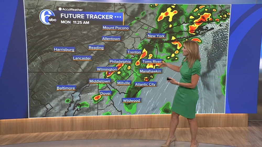
If you're accessing on mobile or app, click to view the interactive map full
"They're expecting it to hit hard," she added.
Dortay Spanier recalled how Hurricane Katrina caused catastrophic damage more than 60 miles inland back in 2005 and understands why people are not taking any chances.
"Some people were leaving and then you hear a lot of the stores were closed and everything, and they stopped the buses from running and everything," said Spanier.
We also caught up with some Houstonians who recall all too well the catastrophic damage Hurricane Harvey caused a few years ago and were keeping a very close eye on Laura.
"It took a turn kind of last minute, we're thinking it's gonna hit right along the border, so we're hoping downtown Houston can get through this unscathed," said John Crommett.
READ MORE: Hurricane Laura near Cat 5 strength as it approaches landfall; 'unsurvivable' storm surge expected
Kathleen and Jerry Meyn had gone to visit family in New Orleans and had booked their flight months ago not knowing it would be one of the last ones out before Hurricane Laura made landfall.
"Just lucky, you know? Luck is good too" said Jerry.
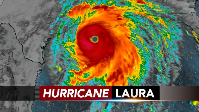
The storm grew nearly 87% in power in just 24 hours to a size the National Hurricane Center called "extremely dangerous." Drawing energy from the warm Gulf of Mexico, the system was on track to arrive early Thursday during high tide as the most powerful hurricane to strike the U.S. so far this year.
Hurricane-force winds extending 60 miles (95 kilometers) from the storm's center neared the coast, forecasters said, and bands of heavy rain fell 30 miles (48 kilometers) from the beach in Lake Charles.
Late Wednesday, Laura was churning about 60 miles (95 kilometers) south of Lake Charles and moving north-northwest at 15 mph (24 kph).
Maximum sustained winds increased to 150 mph (241 kph) before nightfall, and forecasters said up to 15 inches (38 centimeters) of rain could fall. Forecasters issued a string of tornado warnings as the storm pushed on to land, but there were no immediate reports of damage. Thousands of homes and businesses were without power.
-- The Associated Press contributed to this report.