Interactive Map: See current and predicted Philadelphia-area flooding levels


PHILADELPHIA (WPVI) -- When flooding is in the forecast, the below map will show you the current and predicted water levels in local rivers, creeks and bays.
Note: Points on the map will only appear once a waterway is predicted to go above flood stage.
INTERACTIVE MAP
FLOODING CHARTS
You can see the water levels anytime at many local rivers and creeks in the charts below.
PHILADELPHIA
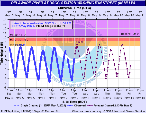
Delaware River at U.S. Coast Guard Station in Philadelphia | Source: National Weather Service
----------
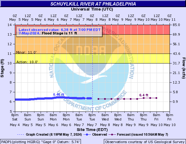
Schuylkill River in Philadelphia | Source: National Weather Service
----------
PENNSYLVANIA
Brandywine Creek at Chadds Ford, Pa. | Source: National Weather Service

----------
Neshaminy Creek at Langhorne, Pa. | Source: National Weather Service

----------
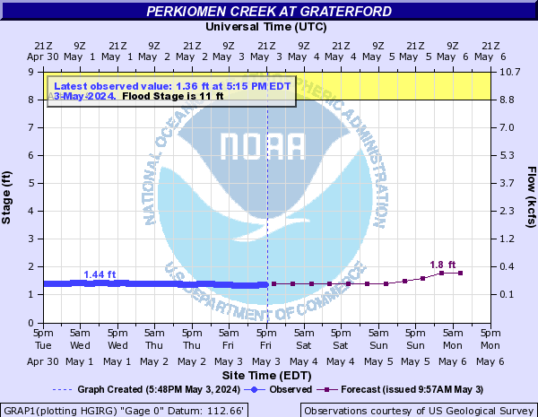
Perkiomen Creek at Graterford, Pa. | Source: National Weather Service
----------
NEW JERSEY
Assunpink Creek at Trenton, N.J. | Source: National Weather Service

----------
Barnegat Bay at Barnegat Light, N.J. | Source: National Weather Service

----------
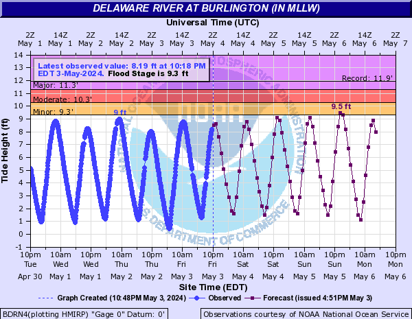
Delaware River at Burlington, N.J. | Source: National Weather Service
----------
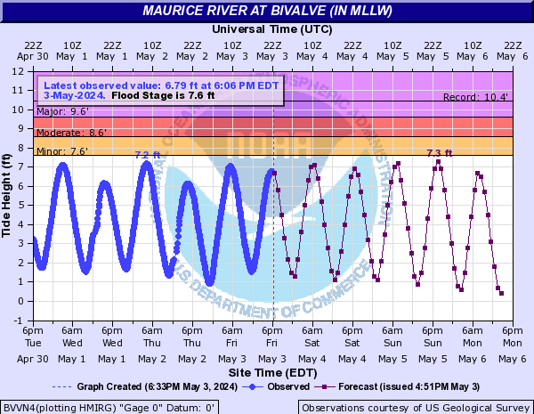
Maurice River at Bivalve, N.J. | Source: National Weather Service
----------
DELAWARE
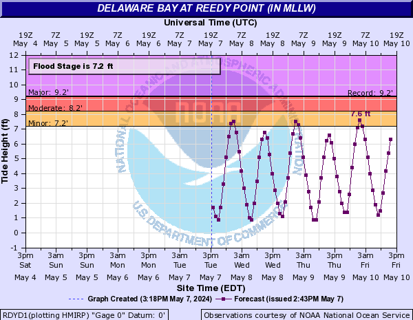
Delaware Bay at Reedy Point, Del. | Source: National Weather Service
----------


